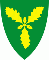
Songdalen
 |
Prior to its dissolution in 2020, the 216 km2 municipality is the 323rd largest by area out of the 422 municipalities in Norway. Songdalen is the 161st most populous municipality in Norway with a population of 6,568. The municipality's population density is 31.8 PD/km2 and its population has increased by 16% over the last decade.
Songdalen was a relatively new municipality. During the 1960s, there were many municipal mergers across Norway due to the work of the Schei Committee. On 1 January 1964, the municipality of Greipstad (population: 2,061), most of the municipality of Finsland (population: 797) except for the Kleveland bru area, and the Eikeland area of Øvrebø (population: 39) were all merged to form the new municipality of Songdalen. On 1 January 1978, a small area of Vennesla municipality (population: 10) was transferred to Songdalen. Then on 1 January 1984, the unpopulated Hauglandsvatnet area was transferred from Vennesla to Songdalen.
On 1 January 2020, the three neighboring municipalities of Kristiansand, Songdalen, and Søgne merged to form one large municipality called Kristiansand.
Map - Songdalen
Map


Country - Norway
 |
 |
| Flag of Norway | |
Norway has a total area of 385,207 km2 and had a population of 5,425,270 in January 2022. The country shares a long eastern border with Sweden at a length of 1,619 km. It is bordered by Finland and Russia to the northeast and the Skagerrak strait to the south, on the other side of which are Denmark and the United Kingdom. Norway has an extensive coastline, facing the North Atlantic Ocean and the Barents Sea. The maritime influence dominates Norway's climate, with mild lowland temperatures on the sea coasts; the interior, while colder, is also significantly milder than areas elsewhere in the world on such northerly latitudes. Even during polar night in the north, temperatures above freezing are commonplace on the coastline. The maritime influence brings high rainfall and snowfall to some areas of the country.
Currency / Language
| ISO | Currency | Symbol | Significant figures |
|---|---|---|---|
| NOK | Norwegian krone | kr | 2 |
| ISO | Language |
|---|---|
| FI | Finnish language |
| SE | Northern Sami |
| NO | Norwegian language |
| NN | Nynorsk |